Hike to Mt. Olympia summit Mount Diablo State Park, California March 24, 2008
Getting there:
On Marsh Creek Rd. in Clayton find Regency Dr. (a light) and turn South.
Go to the end of the road and park. Walk down the embankment to the Southwest to the trail head.
Our hike started and ended here. Elevation 525'.
Walk Donner Creek along Donner Canyon Rd. (dirt).
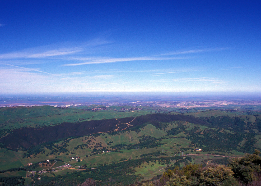
Around a quarter mile you'll see a road across the creek angling up a hill. Cross the creek and follow this road East to Clayton Oaks Rd. (You'll reach the end of Rialto Rd. at about 0.8 miles). The trail turn south here and starts up the hill. Continue up this until you find Bruce Lee Spring Tr. Follow this trail for about 0.3 miles to the Wassermann Tr. Follow this trail until you intercept Donner Creek Rd. again, but you stay on this only a little bit as you find the Olympia Tr. Continue along until you get to the Mt. Olympia Rd. which we followed to the Mt. Olympia summit at 2946'. This is a little over 4 miles and 2412' elevation gain.
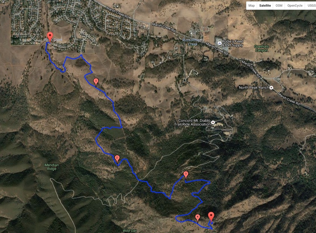
Here is a map rather small map, click on it to go to the saved Google Map.
On Marsh Creek Rd. in Clayton find Regency Dr. (a light) and turn South.
Go to the end of the road and park. Walk down the embankment to the Southwest to the trail head.
Our hike started and ended here. Elevation 525'.
Walk Donner Creek along Donner Canyon Rd. (dirt).
Around a quarter mile you'll see a road across the creek angling up a hill. Cross the creek and follow this road East to Clayton Oaks Rd. (You'll reach the end of Rialto Rd. at about 0.8 miles). The trail turn south here and starts up the hill. Continue up this until you find Bruce Lee Spring Tr. Follow this trail for about 0.3 miles to the Wassermann Tr. Follow this trail until you intercept Donner Creek Rd. again, but you stay on this only a little bit as you find the Olympia Tr. Continue along until you get to the Mt. Olympia Rd. which we followed to the Mt. Olympia summit at 2946'. This is a little over 4 miles and 2412' elevation gain.
Here is a map rather small map, click on it to go to the saved Google Map.
We had the "Mount Diablo, Los Vaqueros & Surrounding Parks and Featuring the Diablo Trail" map purchased from REI in Concord. ©2007 Save Mount Diablo. A great map to have for this hike.