|
In terms of consumables, we used 116 ml of white gas fuel per day, 70% of the planned 167 ml per day. We could have lightened the load by 1/4 of a gallon of fuel.
We also brought 2 lbs of food per person per day, but ate 1.2 lbs per person per day, 60% of what we brought. I think we could have rebalanced the food to have more breakfast and more dinner and less trail snack/lunch stuff, but obviously we could plan on 1.5 lbs per person per day, which could have lightened the load considerably. Our 16 lbs goes to 12 lbs, a significant reduction. From Stephanie's watch statistics: We averaged 2 mph when we were hiking, and 7.4 hours of hiking per day, with 1.24 hours of stops. The total elevation gained was 19,304' and lost 15,762' with a net elevation gain from Yosemite Valley of 3,542'. The watch tallied 110 miles, where as the "official" distance is set at roughly 90 miles. To do the entire JMT at this rate requires 105 hours, and two weeks at 7.5 hiking hours a day. So perhaps we weren't so slow, if the trail is 22% "longer" the two week trek would require 9.2 hrs/day of hiking. Continuing on the trail from Edison Lake, we have 120 miles to do, just scaling from this trip we'd take 9.3 days. Food for 10 days would weigh roughly the same as we had for 7 days. Stephanie thinks that our JMT "t-shirt" should say "More Switchbacks!" In recognition that the modern Army marches "on its batteries" we had two batteries to recharge the various devices with: the battery from the "Goal Zero" solar panel, and one larger battery (with a small panel for trickle charging). The "Goal Zero" panel worked well and charged the batteries during the day hiking. We'd leave the second, heavier battery at home on a multi-day backpack next time. It's probably more appropriate for the weekend trips. While I didn't think the foldable bucket that Steph brought was needed, it was in terms of managing washing, where water could be scooped and used and dumped away from water sources. But going planning next time will definitely focus on reducing weight.
2 Comments
We did get up early, eat a quick "breakfast snack" and departed our camp. We started at 8,300' and dropped down to 7,600' and those few miles seemed impressive in themselves, especially when thinking about the ascent up to high country. We passed many parties who obviously started early, and we warned them that there were sparse chances for water. Sometimes we actually were able to communicate, if I recall, the parties seemed to be Japanese and Korean hikers with varying English language skills. The trail flattened out and Mono Creek slowed as it made its way to Lake Edison. The story of the creation of the lake is interesting, but I'll tell it elsewhere. Before we knew it, we were at the trail junction. 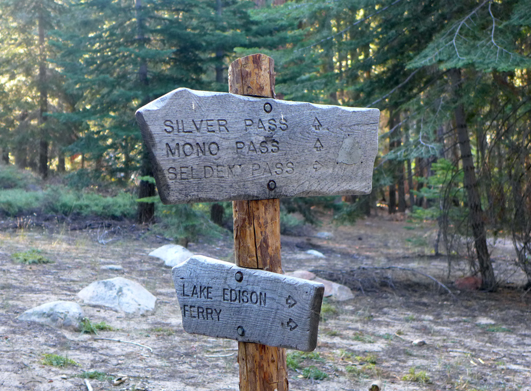 And just a bit more time we were at the landing spot, the first there. Distance this day was 2.8 miles, 200' of elevation gained, 900' lost. The day's kml file. The "taxi" arrived and we boarded, with one other backpacker and made our way to VVR. Debbie was on her way and expected to arrive around noon, we had arrived at about 10 am and after checking in we had a huge breakfast. 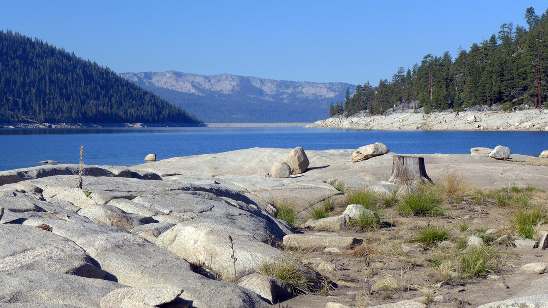 Edison Lake dam as seen from the Northeast end of the lake from the water taxi landing. During our wait we plotted out the possibilities for next year.
What a grand time. The goal today was to go over Silver Pass and down to Mono Creek Junction, or there about. We had to drop down to Cascade Valley, cross Fish Creek, then crank up and over the pass and then down into the Vermillion Valley. 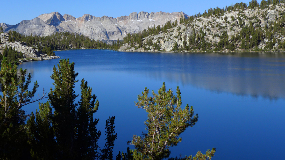 A last look at Virginia Lake. This is amazing country to be in, and more amazing to just walk it day after day. 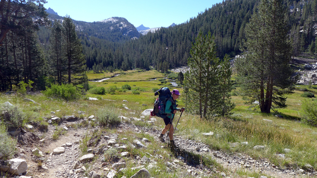 Coming down into Tully Hole. Walking down Fish Creek and crossing at the bridge, we began our ascent up to Silver Pass. First to Squaw Lake, at which we stopped and enjoyed the refreshing water and some lunch. Then back to the trail which would take us by a series of high lakes on to the pass. 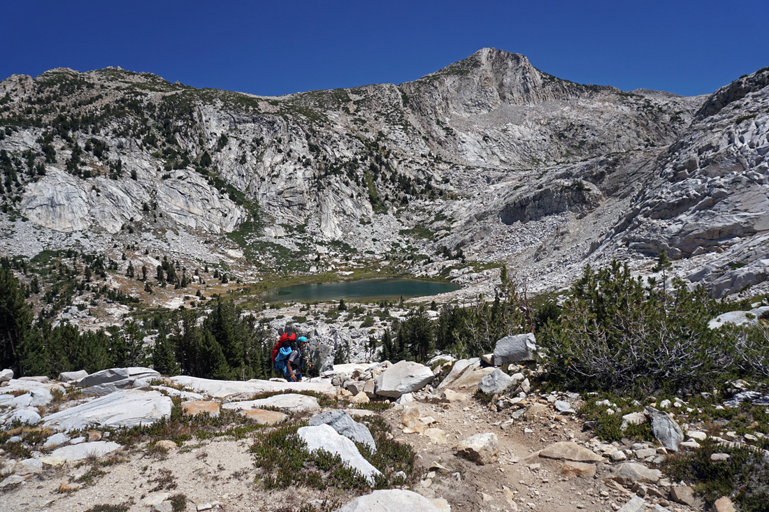 On the trail above Squaw Lake. And finally at 10,800' at Silver Pass, with views looking back at country we'd been through 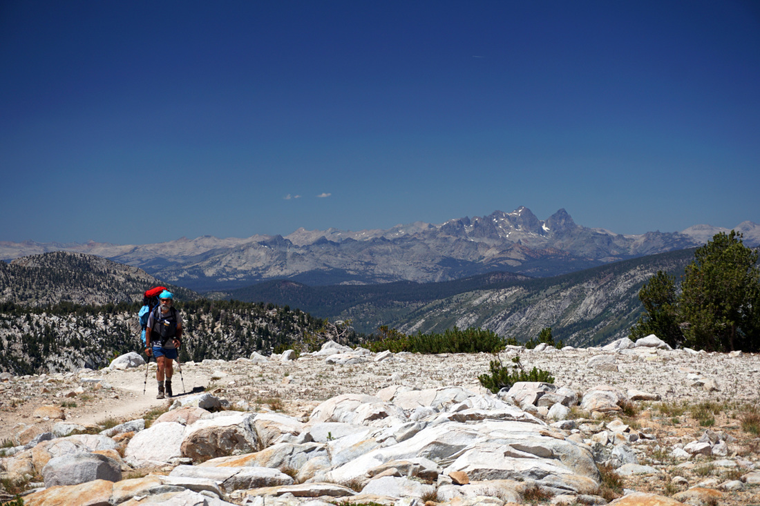 Coming over Silver Pass on the JMT. and views of places we were going.  View of Vermillion Valley from Silver Pass on the JMT. Sliver Lake was the last major water on this long and hot trail. Not only that, but the descent to the Mott Lake Junction crashes down out of the high country to join the North Fork of Mono Creek.  Looking back up the descent to the North Fork of Mono Creek along the JMT. We managed on down the trail to find a nice campsite. A couple of backcountry rangers with the Forest Service thought we were too close to the trail, so we started the hassle of moving our camp. While doing that I disturbed an ant hill and hundreds of ants swarmed out to find a bivouac, over all our gear causing a lot of consternation. We moved back to where we had been. Very curious yellow jackets committed suicide in the water boiling up for dinner, though they did not seem at all interested in the vegetarian fare. With the various dramas done for the night, a cup of tea was extremely welcome. 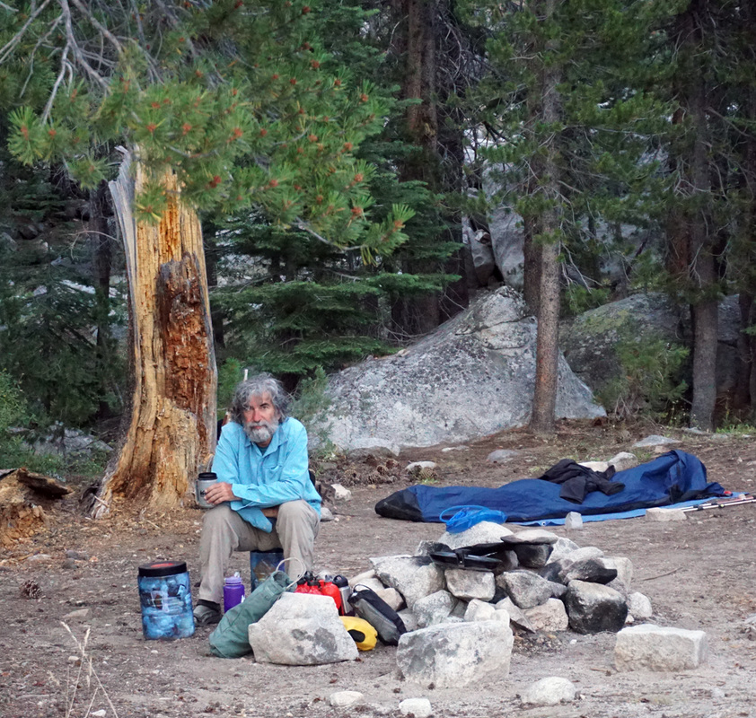 Steph and I discussed the strategy for the morning, light breakfast and getting on the trail as early as possible to get to the water taxi on Lake Edison in the morning, a luxury to transport us to the VVR.
This day we had hiked 11.7 miles with 3,100' elevation gained and 5,100' lost. The day 7 kml file. We had been discussing exit options since it was clear we didn't have enough food to stay on the trail to the end. We were at day 6 with one or two days to get to Muir Ranch where we had sent 4 days of food, thinking we'd be there on day 6. The options we discussed were to exit at Muir Ranch down to Lake Florence, hike to Le Conte ranger station and exit over Bishop Pass, or perhaps hike to the Taboose Pass junction and exit there. But while discussing it this night, we decided to exit on Lake Edison at the Vermillion Valley Resort. That would be in two days, and Debbie could pick us up from the west side (although it turned out to be a very long access). We could communicate this to Debbie with Stephanie's InReach satellite communicator which we had been using since day 1. Debbie often had a better idea where we were than we did. Oddly, having decided to exit, nothing really changed. We still had a day and some to hike and all the various activities that would go along. The journey finally did take over the plan. 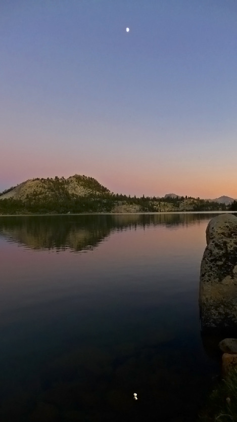 Moon over Virginia Lake.  Stephanie captures the early morning Sun on the trail above Deer Creek. Breaking camp was becoming routine, packing all the bits in all the right places after breakfast chores got us moving up onto a contour that would wind around to Duck Pass Junction, then down to Purple Lake and up and over Virginia Lake, and maybe farther. Our ambitions were always farther, of course. Just before noon we hit the stream crossing below the junction, stopped to cool off, filter water and eat a snack. By now we had been running into other hikers that we'd been encountering along the way. A couple of young women had started from Deer Creek as we went buy, we passed each other a couple of times, and as we settled into our break they joined us at the creek. 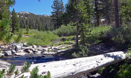 Stream crossing below Duck Pass Junction. A short but steep ascent took us onto a higher contour for many miles, with spectacular views into Cascade Valley. We'd walk the length of it and then cross it to get to Silver Pass, but I'm getting ahead of the story. 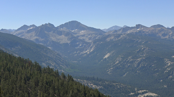 Cascade Valley from the JMT. By about 1:30 pm we were making the descent into Purple Lake. We had past a party of three, son, father and grand father who had hiked a loop from Red's Meadow, down Fish Creek and up the Purple Lake trail. It seemed like a great idea. The son was very concerned about the "bug situation" at Deer Creek, I don't think we had an opinion, sometimes the bugs annoy and sometimes they don't... the yellow jackets were a slight annoyance at dinner times, but so far the bugs didn't seem too bad. Just as we were coming into Purple Lake a hiker with a British accent passes us, very excited: "I kid you not! There are people down at the lake serving tacos and beer!" and was by us just as quick to collect his kit and enjoy the feast. Indeed, as we came along the lake edge we encountered a group of about 6, the delicious smell of fresh food wafting up from their station and various banners and matching t-shirts: Senior Muir's Taco Hut "Serving hungry hikers since 2014" #MuirTaco. The wonderful people had had their supplies packed in and were serving hikers on the trail this wonderful food. This is an activity the was started by the people who run the socalhiker.net website. We didn't have time to stop as we still had to hike up to 10,500' but they insisted that I take a beer for later. I couldn't refuse. On our way up the two packers on horses where leading a mule "She doesn't like backpackers," the lead cowboy warned, "but she won't do anything to you" as the mule made a big path around me on the side of the trail. Stephanie said the mule didn't really react to her, so maybe it was just me? Stephanie was pretty quiet on this part of the hike, and of course I snapped a picture that got a reaction every father gets from his daughter at some point. 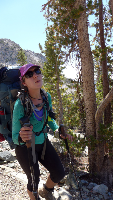 Now I'm in trouble... the unwelcome attention. At that point we went over the pass and into the glorious Virginia Lake. As we descended to the lake shore I hinted, broadly, that it would be a great place to stop for a rest. Stephanie was not very interested, she wanted to continue on, our goal for the day was in the distance and we had plenty of time to make a go at it. But as we rounded onto the other side of the lake she decided that she had to stop and eat. "Hangry" a term I sort of heard, but now was experiencing it in my hiking partner, which made a very vivid definition. Later Stephanie explained that she hadn't wanted to stop for long because her ankle would get sore, so she had neglected eating much that day and was paying the price. I couldn't be counted on to stop to eat, I didn't eat after noon. So we stopped and Stephanie refueled. The lake was beautiful and inviting, some fellow travelers were enjoying a swim nearby. 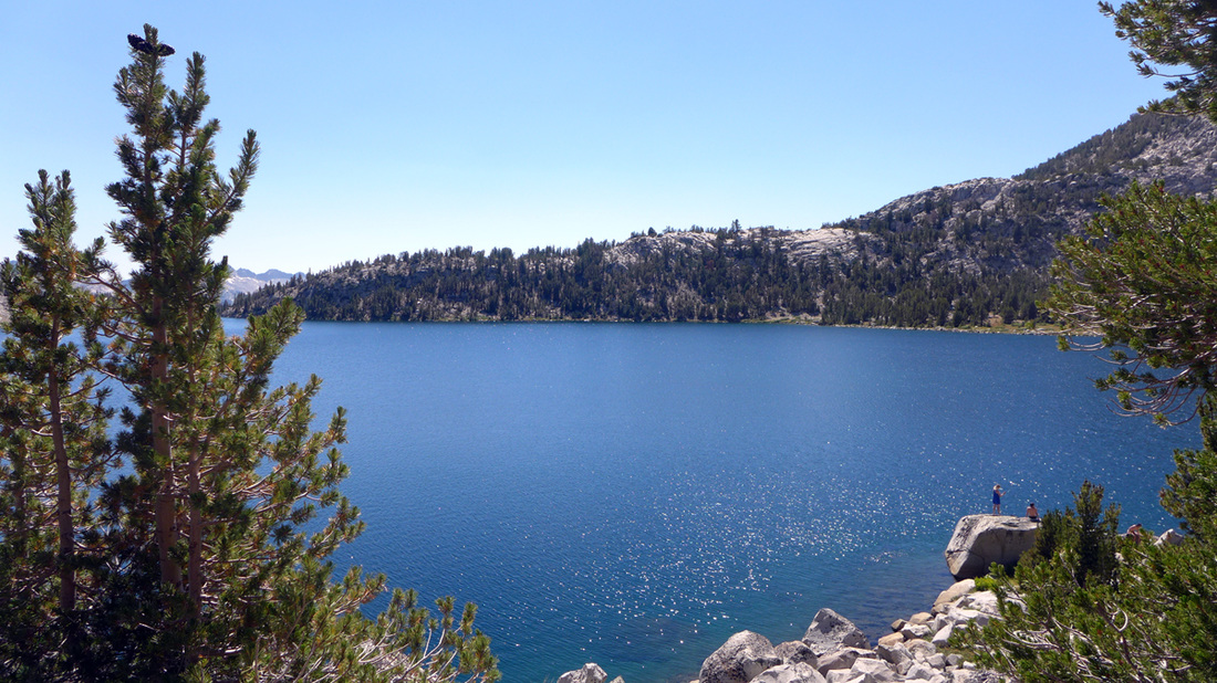 Virginia Lake, a beautiful spot along the JMT. Sitting for a while, the packers somehow arrived, apparently they had diverted off the trail and then back on, after we had passed. The mule was still very suspicious of me, and my pack which was sitting near the path, she diverted around once again. 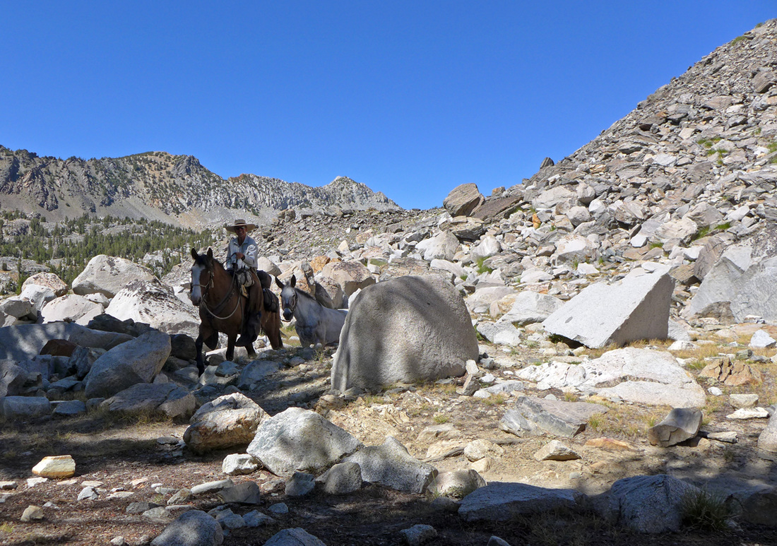 Trips that are supported by packers seem quite common in these parts of the Sierra, at least as evidenced by the number of "road apples" encountered. My sinus seemed always congested by the dust on the trails, I tried to convince myself that the biotic infusion would be good somehow. We decided to camp at Virginia Lake, it was cooler up high, and the site was picturesque. We back tracked around to the other side and set up camp. While a number of hikers arrived for the night, they seemed to congregate around the trail, we weren't that far off it but apparently farther than most of them wanted to go. We had time to get washed up a bit, the water was pretty warm, I drank the beer, and we watched the sunset. 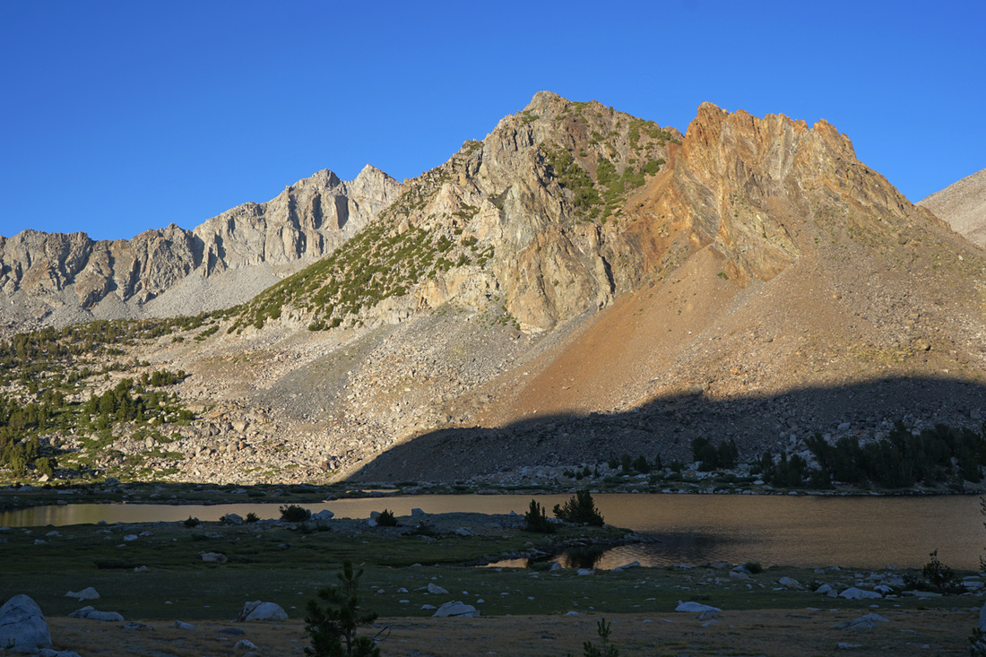 Stephanie captures the evening light above Virginia Lake. This day we hiked 11 miles gaining 2,700' and loosing 1,600'. The high point was just before reaching Virginia Lake. The day's kml file.
It was a good day for me, I think maybe the best one so far. Life on the trail falls into certain routines, and when you're with others there is a tacit understanding of the various rituals. By Thursday I had figured out a hiking pace that didn't complete debilitate me. A byproduct of the exertion was my complete disinterest in eating or drinking much after noon. Stephanie attributed some of that to electrolyte imbalance, which made a certain amount of sense. The ritual that seemed to be working had to do with electrolyte replenishment. After breakfast I'd have one SaltStick tablet. This contained about 10% of the daily salt requirement, and some other salts to match perspiration electrolyte losses, and some vitamin D3. This was enough to cause me to start drinking water in quantity, like 2 to 3 liters. On the trail I'd sip water, usually about 1 liter by mid-day, usually I'd take another salt tablet at noon, with some water, and eat a very little bit. After that I'd usually not drink much water until we stopped for the day. Eating on the trail mostly consisted of sucking on Jolly Ranchers, about 33 Cals. per candy, and I'd take 5 or 6. The food choices for the trail and for lunches really didn't appeal to me so far. When we'd stop I'd have the GU Recovery drink, which had a similar amount of electrolytes as well as sugars designed to replace muscle glycogen stores, some proteins and some vitamins all "designed" to help the muscles recover quickly. In my experience this worked, my muscles never seemed sore from the exertion. The salts in the recovery drink also caused me to drink a lot, aiding in the rehydration. The last bit of the ritual was taking 800 mg. of Ibuprofen. We'd been out long enough that this seemed to be working. And the incremental decrease in food weight was also helpful. The crowded situation at Rosalie Lake had us moving fast to pack our kit and get out on the trail, and we were off before most everyone else. The climb up to Gladys Lake was one last trip to 9,700' feet before a very long descent into Devil's Postpile. Passing that lake in the morning had me wishing we pushed just a bit more yesterday.  Morning light on Gladys Lake. The descent was fast, the morning would be spent walking through some incredible places. By 11am we had made the boundary between the National Monument and the National Forest 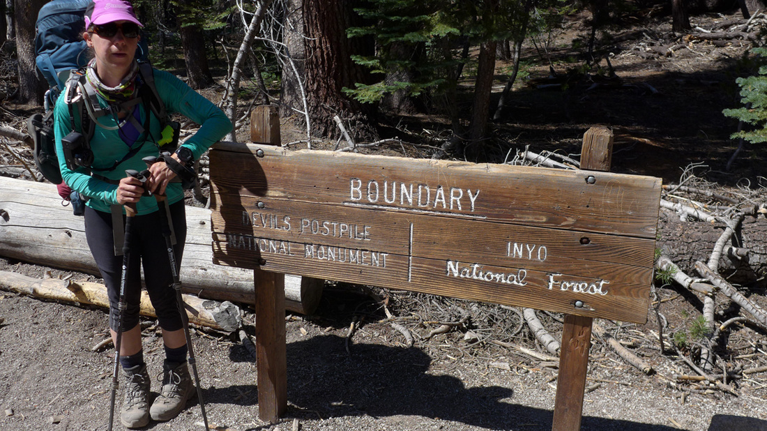 At the boundary! Stephanie's ankle was a bit sore from the quick downhill pace. We headed off down the trail for another hour coming first to the ranger station. There we filled up with water, dumped trash and used the restrooms. We made an inadvertent side trip and saw the "postpiles" which was somewhat underwhelming, considering the country we had been moving through these last few days. 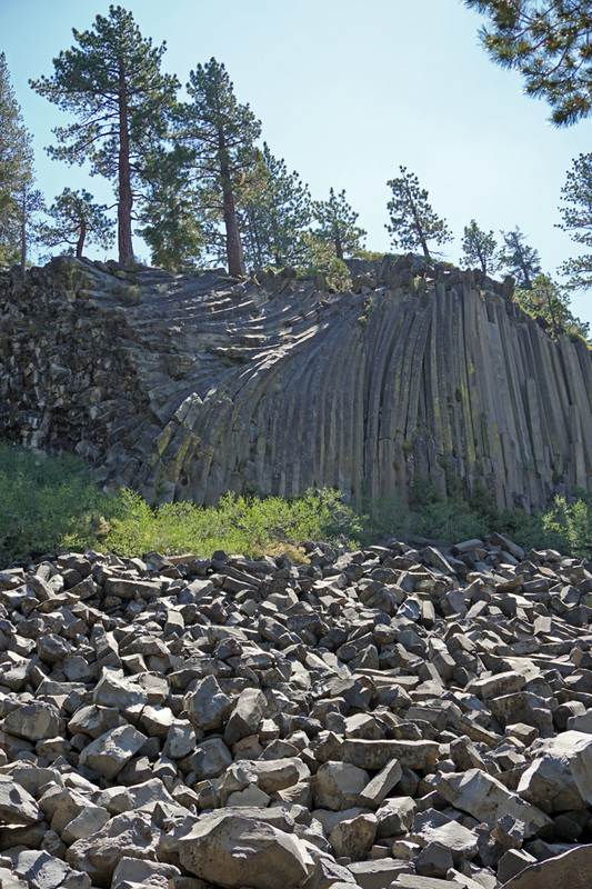 Steph's image capture of the tourist's display at Devil's Postpile NM. Another mile and a half we were at Red's Meadow Resort, on time for lunch. The area outside of the general store collects all the hikers on the trail, the scene is a backwoods counterpart to the Star Wars Cantina, though all the denizens are human. We struck up a conversation with an older guy who had come over from Mammoth to meet up with his wife for a day hike. He had hiked the JMT previously and that started a long discussion of places remembered. It was a welcome break and the first civilization in 3 days. We had started to recognize fellow hikers and made subtle acknowledgements of each other, which would later turn into the requisites for friendship. After eating some fruit, and drinking a Coke, we shouldered our packs and started of. The area immediately south of Red's is a forest that was completely wasted by a November 2011 storm. The associated wind event fell thousands of trees in the Sierra including many along this stretch of the trail. The Inyo National Forest issued a report stating the estimated wind gust speeds on Mammoth Mountain were 180 mph. The patch of downed trees is about a mile across and two miles long. This made for a very warm hike before heading up the hill to our destination, Deer Creek, compounded by the relative absence of water long this stretch of trail.  The hike out of Red's Meadow, looking back at the Minarets on the skyline, and down at the devastated forest below. We got to a very nice creek just short of Deer Creek and decided to stay. We shared the spot with two women hikers who were together. We were learning that the "named" camping spots were very crowded this year. We got in early enough to do laundry. Stephanie had the smarts to bring a "bucket" and we could fetch water and wash in the bucket without feeling like we were polluting the beautiful creek.
Another benefit of our spot was cell phone coverage. We called Debbie and discussed possible early exits, my slow pace and now Stephanie's ankle suggested that we might not make our goal. The day's progress was pretty good, 14 miles with 2,600' of elevation gained and 2,700' lost. We seemed to be adjusting to the trail. All the chores completed, we were in bed as the Sun set. The day 5 kml file. Everyday we set a goal to have an end point in mind. Today we thought somewhere near Red's Meadow. Amazingly, my body seemed to be holding up, all the normal complaints of civilized life were absent, my back was fine, my knee, my hips, all the usual joint complaints. Sleeping 10 hours seems to be a good idea. Breakfast today was scrambled eggs with cheese... which was very good, a sort of calorie bomb much appreciated. Now routine, we packed quickly and took off on the trail. Our descent down to Rush Creek Trail junction went quickly, then the climb up to Island Pass, 10,200', didn't really seem like too much. The descent treated us to views of Mt. Banner and Ritter, and Thousand Island Lake. 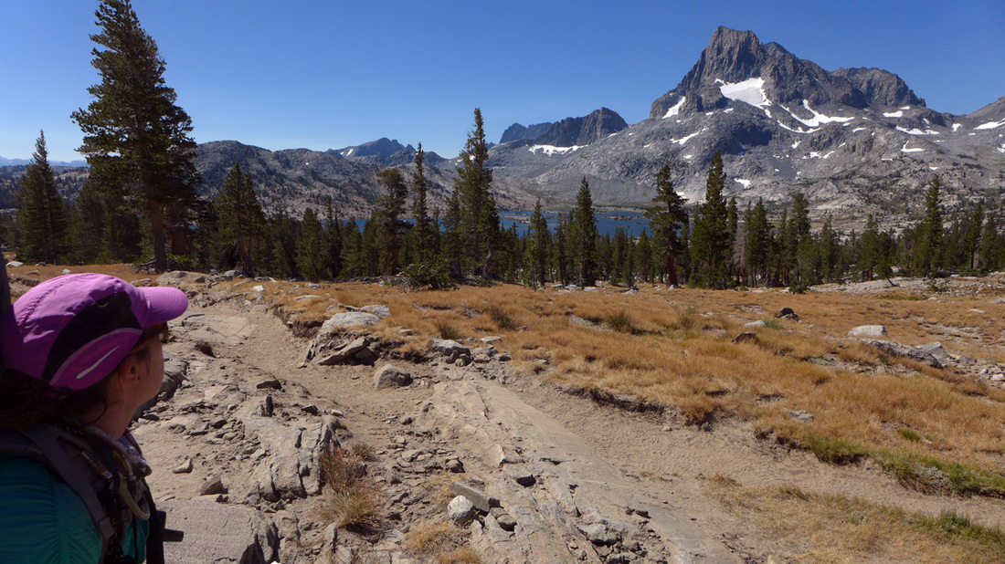 The vista from the trail descending out of Island Pass. We'd hit a whole series of lakes today, which means dropping down to lake level and climbing over the ridge that separates it from the next lake. Each time great views of where you have been, and where you were going. At the mouth of Thousand Island Lakes the JMT splits off from the Pacific Coast Trail (PCT) which departs more directly to Devil's Post Pile. We had some snacks just off the trail above Emerald Lake. I actually ate some lunch for the first time in 4 days! Then back to hiking, passing Ruby Lake and up to the next pass at 10,100'.  This was also quite tolerable, and we were up and over and descending to Garnet Lake quickly. On the way down as we passed a couple of backpackers I thought I recognized the pack one of them was wearing. I turned around and asked "Is that an Alpinlite pack?" and the guy replies "Yes!" He's an older guy, and it turns out that he believes Alpinlites are the best packs for long trips. He buys them off of eBay, and the one he was wearing looked quite new. I recognized the pack because I worked at Alpinlite when I was in High School my senior year, which would be 1971. The pack he had was a later model, but the distinctive aluminum external frame was basically the same. I had an Alpinite on my first JMT attempt. We chatted a little bit, I really had none of the information he was looking for, like what had happened to the company. His hiking partner asked me just where the "factory" was, all I can remember was some very old buildings next to the railroad tracks downtown Claremont. I'm sure those buildings don't exist anymore. Apparently they had moved to Ventura at some point after I went off to college. It was amazing to see that pack, a relic of the past that I had some connection to in a real way. We hiked a short distance to the bridge, took a break, and then started to climb out once again, over yet another 10,100' pass. 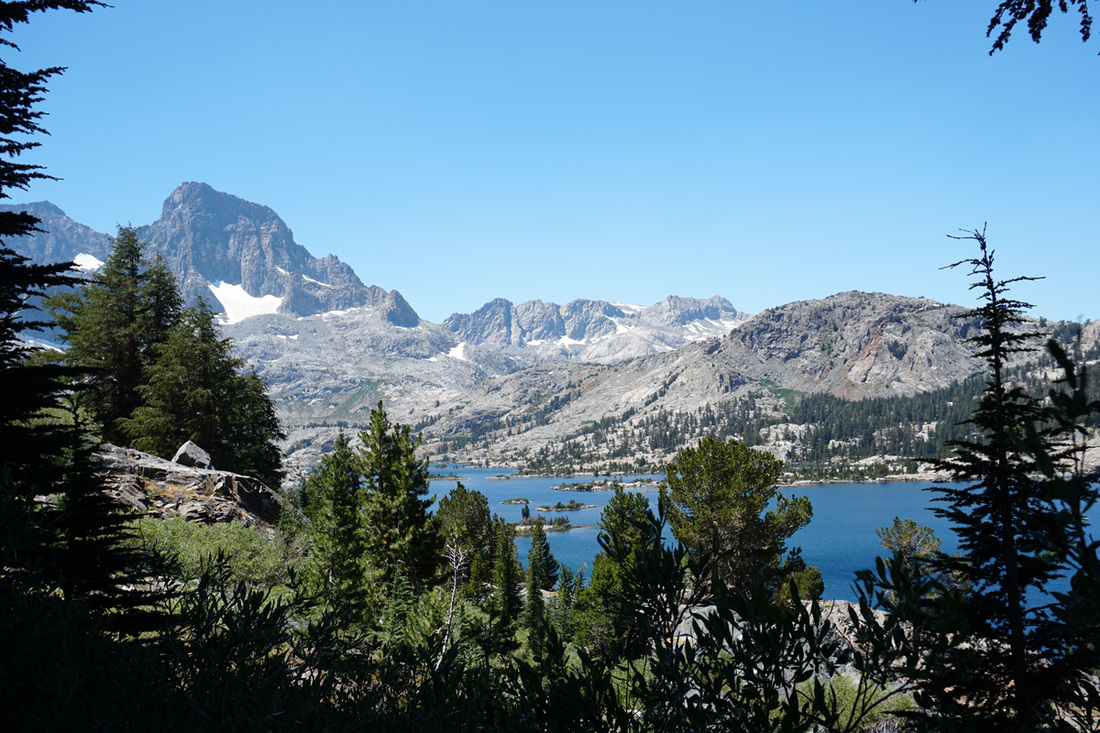 Steph's shot looking back at Garnet Lake. Getting over this next pass we dropped into the valley containing Shadow Lake, first picking up Shadow Creek. Hitting the Edzila Lake trail junction we were getting a bit warm, and a bit farther along the trail we stopped.
I doused myself in the creek while Steph filtered water. We were using a Platypus GravityWorks filter, which I consider a huge advance over the old hand pumped filter. I was cooled off and ready to roll. Down a bit farther the trail junction to Agnew Meadows turns off at the bridge across the creek. Shadow Lake is at an altitude of 8800' and we had to go back up to about 9400' to get to Rosalie Lake. Most of this climb is in the shade of the pine forest, but it is a lot of altitude gain in a short distance 600' in a mile. Once again I went to a very deliberate pace, an hour later we were over the pass and headed for Rosalie Lake. Our daily schedule was evolving to roughly 9 to 10 hours of hiking a day, and stopping around 5pm. And when we got to the lake we decided to stop. Gladys Lake would have been a better place, fewer people, and probably better tasting water. By the time we dropped off to sleep, all the camping spots seemed to have been occupied. We did 12 miles this day, gained 2470' and lost 3279', click the link for the day 4 kml file. This day was, officially, Stephanie's longest backpacking trip! Lyle Canyon seems to be filled with light all day, but it takes a while for the Sun to rise. The cold morning and lack of Sun had Stephanie retreating back to her tent to get warm after breakfast. Her hands had become numb. I was doing OK, and started getting stuff organized for the daily routine of packing up, 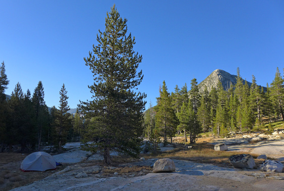 Lyle Canyon Sun rise at 8am, Potter's Point in the background. This was our first "normal" day, eating food out of the Bear Vaults. Breakfast was pancakes and coffee. For the trail I was Jolly Ranchers, and Steph her coveted GU Stroopwafels. Once the Sun hit our camp everything warmed up and we were on our way, albeit a bit later, once again... but it was still early in the trip and a certain level of leisure was being obtained. The day's hike would go up in two pieces, the first to Lyell Fork bridge, the up and over Donohue Pass at 11,000' roughly 6 miles from our camp. 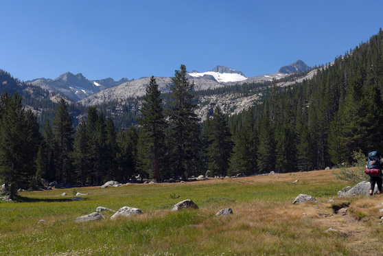 The upper reaches of the Lyell Fork with the objective looming up above. We arrived at the bridge in time for lunch. The cool stream was a welcome refreshment. 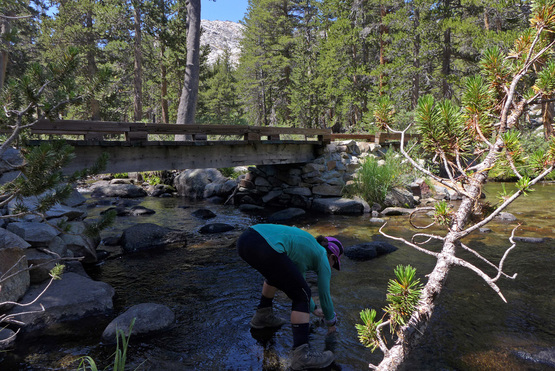 Lyell Fork bridge. The climb out would really test me. I had been trying to figure out a pace that would not leave me totally spent. Moderating my exertion to be less than maximum output was a priority, the first day I was unable to eat or drink much after noon, and even at dinner time I wasn't very interested in dinner. On this day I determined to move at a pace that allowed me to breath through my nose. That seemed simple enough, and it was slower. Stephanie's aerobic capacity was/is much better than mine, and it was a concern that I had regarding the trip. Could I actually do it? The good news of the day was that the packs didn't seem all that heavy, certainly not the boat anchors imagined on the hike out of Tuolumne Meadows. The country we were hiking through was also much more alpine, and dramatic. Stephanie had plenty of time to capture images of my labors, here above what is referred to as "upper Lyell base camp" 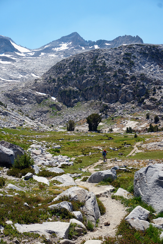 Starting the last long up to Donohue Pass. The views are always spectacular and it is with singular pleasure to look back over where you had just come from, awed by the results of just putting one foot in front of the other. 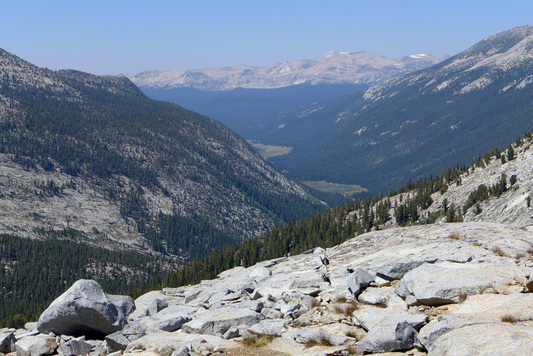 Looking down into the Lyell Canyon high up on the trail to Donohue Pass. After a long time, we arrive at Donohue Pass at 3pm. The resident ranger checked out our wilderness pass. She had quite a crowd up on the pass, mostly hikers headed north into Yosemite. We rested up and had our picture taken at the Ansel Adams Wilderness boundary sign, we had finally made it out of YNP! I managed a smile here... and probably wasn't as bad off as I felt. We had a ways to go, by our new plan, but mostly downhill. 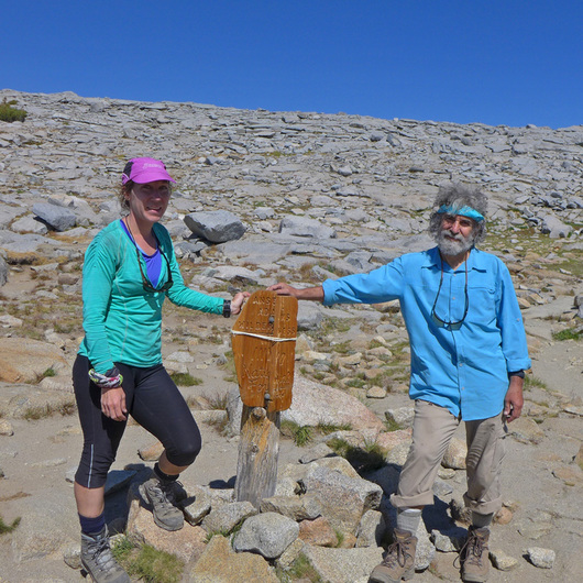 Donohue Pass, an accomplishment. As we descended towards Rush Creek I started to become very tired. We got about 2 more miles and I really wanted to stop for the day. My fatigue was a real worry, certainly we were going to go up over higher passes, but my slow pace seemed to suggest that we might not be able to go as far as we planned for this trip. I was bummed. We setup camp, made dinner and got through the cleanup. Stephanie had time to breakout her camera and play around with it for the first time on the trip. We were camped at a very beautiful spot, it didn't really matter what the schedule was now, the trip had taken over the plan. 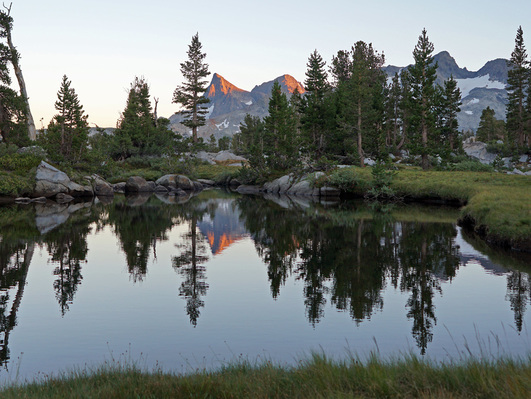 Stephanie captures the alpenglow at the end of day 3. Day 3 had us 9 miles further along, after climbing over the 11,060' Donohue Pass. Total altitude gained was 2621' and lost 1316'; the day 3 kml file.
The amazing thing about day 2 is that it seemed that, upon waking, the body was fully recovered from day 1. Of course more than 10 hours of sleep will help, a comfort greatly aided by my new Thermarest NeoAir. That along with the restorative power of GU recovery drink (which may be purely psychosomatic, but it seemed to work through the months of training). We had some leftover trail snacks from the day before, and some tea, our plan had been to walk about 3 miles and have breakfast in Tuolumne Meadows where our cache awaited us, and our new plan, walking 9 miles, would delay that quite a bit, more like lunch. The Sunrise High Sierra camp definitely gets the Sun early, which was good. We didn't have much to linger for... collecting our kit and getting ready was quick. Here is the view from our camp across the meadow, the bear boxes and the composting toilets conveniently near by. 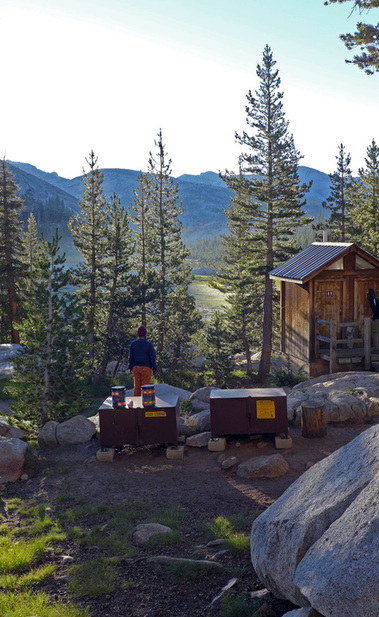 Sunrise HSC backpackers' camp site view. At less than a mile out, we had intersected the part of the trail we took on our Merced Lake trip, but on that day we had done about 3000' elevation gain in 5 hours. Today we covered the ground, up and over Tuolumne Pass and down to Tuolumne Meadows, without it seeming an effort at all, it was delightful to be surprised with how quickly we made progress compared to just a month previous. It went so well that neither I nor Stephanie took any images until we camped that night. Our goal was to make it over Donohue Pass, and beyond. Noon arrived and we were taking our packs off in front of the Grill. We shared a Coke, and some fresh fruit, used the bathrooms and went to collect our cache. Sitting around, sorting, packing and eating a bit more lunch we had things pretty much ready to go by 2pm, which was a little bit later than I thought we'd take. The increased weight amounted to something between 16 and 18 lbs for each of us, and these were the heaviest the packs would be. This was a half a gallon of white gas and a full Bear Vault full of food for 7 days, and the split of today's food was the additional load for each of us. The packs were probably over 50 lbs with all the other stuff. While I had experience carrying huge packs long distances, this was the most Stephanie had every carried. And both of us experienced the thought that these packs might just be impossible. It was certainly a good idea not to carry that load up from Yosemite Valley! But experience can always be counted on to dismiss any thought of suffering, experience is having had an even worse time in the past, and reminding yourself of it. Here is an image of a trip I took in 1993 when our packs were 60+ lbs (I remember 70 lbs), with a couple of weeks of food, and gear for both rock and ice climbing. That was a long day! And I had memories of it while Steph and I hiked under our huge packs. Could it have been 14 years ago? 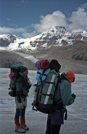 Mike Church and Lawrence Wiencke carrying up the Saskatchewan Glacier headed to the Columbia Ice Fields, August 1993. The day was getting hot, the trail out of Tuolumne Meadows was familiar to us, and it was mostly a gently rising trail until the climb up to the Pass. We trundled on. Crossing the bridge at Rafferty Creek took Stephanie beyond her previous experience. It would take me to the Evelyn Lake trail junction to be in new territory. As we walked, laboriously, I was thinking of our options. All the rangers we had talked to discussed the bear situation, and warned of "habituated" bears along the Lyell Canyon stretch. So I had wanted to go beyond if possible... but by 5pm it was clear that the Sun would set early in the canyon, and that we weren't going to make much more progress. So we stopped and found a camp site that met the requirements: 100' from water and 100' from the trail on a "durable" surface. We happened to choose a spot across the river from the NPS trail crew. This wasn't readily apparent, aside from the contraption that looked like a solar panel ("but how could it be" I thought when I saw it). We passed three crews working on improvements, hard labor moving rock, digging out trails, and all that. Just as we were setting up camp they were heading to dinner, and the smoke from their campfire revealed a tent city hidden in behind the trees. They seemed to be living pretty large over there... ...making our dinner and cleaning up, we collapsed by 8pm, shortly after sunset. Our progress was not "on schedule", but not quite a day behind, a fact that seemed to instill some optimism.  Sunset in the Lyell Canyon. Day 2 statistics: we hiked 15.2 miles, Tuolumne Pass was the high point at 9950' with 1610' elevation gained and -2120' lost. We camped at 8859' in Lyell Canyon; the day 2 kml file.
The first day on the trail would take us from the Backpackers camp across the Merced River from North Pines camp ground, elevation 4000' up and over Tuolumne Pass about 10,000' and then to Lower Cathedral Lake for the night. That was the plan. This presumed that we had driven up the day before, left our cache of 8 days of food and 14 days of fuel in Tuolumne Meadows, and then get dropped off in Yosemite Valley, Debbie was the designated driver. Caching was straight forward, but the Yosemite Valley traffic was horrific, and Debbie dropped us off on the north side of Sentinel Bridge, it took us the better part of an hour to get there from the El Cap meadow turnoff. From their Stephanie and I walked out to the campground and found a place to sleep... eating that night in the place formally known as Curry Village.  Site 8 at the Yosemite Valley Backpackers' camp. We got up early the next morning, had a quick breakfast, packed and were off to find the trail. While the start of the trail is listed as "Happy Isles" you get there in maybe a mile or so... 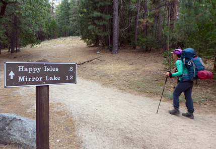 ...then onto the trail proper, sign and all. 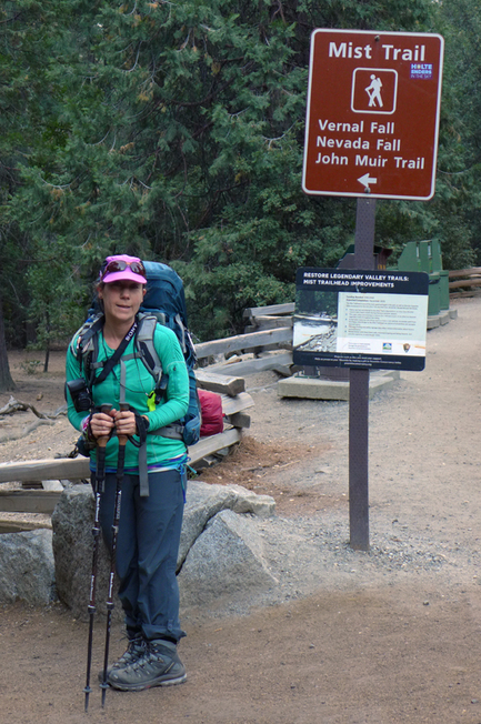 Our route would take us up the switch backs that depart the Mist Trail just beyond the bridge. Given our packs and the day we were facing, that seemed the most prudent plan. These ascend the slope to the Panorama Trail and then heads east contouring to the top of Nevada Falls, avoiding all the stairs. The top of Nevada Falls is at 6000' so we get 1/3 of our total altitude. A short break allowed for the appreciation of the magnificent Valley. 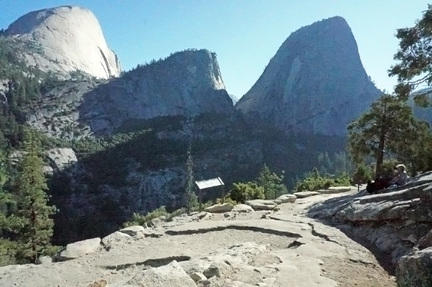 Rest stop on the Panorama Trail, Stephanie Hartouni image. At the outhouse located just beyond the upper junction with the Mist Trail we encounter the bedraggled group of hikers we started out with, they were a bit faster than us, but we definitely had a much better time. We greeted them and moved on. From here we climb up to the saddle between Half Dome and Cloud's Rest before moving east behind Cloud's Rest. Another 2000' elevation gain gets us to the trail junction down to Lake Merced, seemingly known ground. The part of the hike starts to become hot and dusty. Part of this has to do with the Meadow Fire of September 2014, I was climbing with Linda that weekend and we spied it from our route. 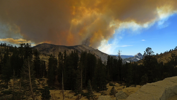 The Meadow Fire, September 7, 2014 from Olmstead Pt. 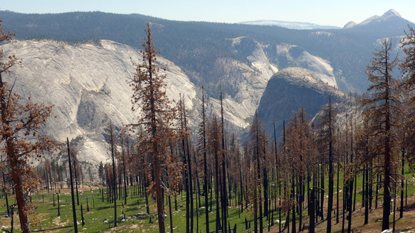 Looking down past the burned forest into the Merced River gorge at Bunnell Pt. with Mt. Starr King in the distance. The forest that once shaded the trail burned down, leaving us to toil up in the full Sun during the afternoon. This was the first of a number of stressful days as I worked out my hydration scheme. Stephanie was the champ going up hill, I felt every bit the old man I was, but my problems probably were always there, feeling ill not because of altitude, but because of exertion. The JMT eventually finds "the switchbacks" which ascends up to Sunrise High Camp. This turned out to be totally exhausting for me. We were running out of time for the day, and we were pretty worked. But not only that, a ranger we had met on the trail up, checked out our wilderness permit and eventually learned of our plan to camp at Lower Cathedral Lake without a bear canister. He was quite upset, but didn't cite us (we didn't have one with us, planning on eating everything) and said that either we should stay at Sunrise, or in the Tuolumne Meadows backpackers' campsite, each of which had bear boxes. If we did not we'd be in trouble! After quite a day we were happy to comply with his instructions. 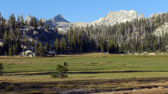 Meadow adjoining Sunrise High Sierra Camp, Matthes Crest in the background. The total distance was 14 miles (though Stephanie's GPS watch showed more, with a total elevation gain of 6960' and loss of 1590'. Our highpoint was at 9700' at 12.5 miles, so we were going uphill pretty much the whole day.
The day 1 kml file has a combination of the various bits of information, including the track from Stephanie's watch. |
AuthorEd Hartouni is a physicist and a climber who lives in Livermore, California. ArchivesCategories |
 RSS Feed