|
The first day on the trail would take us from the Backpackers camp across the Merced River from North Pines camp ground, elevation 4000' up and over Tuolumne Pass about 10,000' and then to Lower Cathedral Lake for the night. That was the plan. This presumed that we had driven up the day before, left our cache of 8 days of food and 14 days of fuel in Tuolumne Meadows, and then get dropped off in Yosemite Valley, Debbie was the designated driver. Caching was straight forward, but the Yosemite Valley traffic was horrific, and Debbie dropped us off on the north side of Sentinel Bridge, it took us the better part of an hour to get there from the El Cap meadow turnoff. From their Stephanie and I walked out to the campground and found a place to sleep... eating that night in the place formally known as Curry Village. 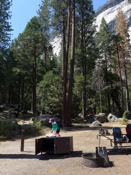 Site 8 at the Yosemite Valley Backpackers' camp. We got up early the next morning, had a quick breakfast, packed and were off to find the trail. While the start of the trail is listed as "Happy Isles" you get there in maybe a mile or so... 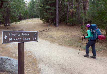 ...then onto the trail proper, sign and all. 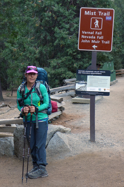 Our route would take us up the switch backs that depart the Mist Trail just beyond the bridge. Given our packs and the day we were facing, that seemed the most prudent plan. These ascend the slope to the Panorama Trail and then heads east contouring to the top of Nevada Falls, avoiding all the stairs. The top of Nevada Falls is at 6000' so we get 1/3 of our total altitude. A short break allowed for the appreciation of the magnificent Valley. 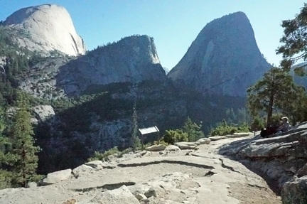 Rest stop on the Panorama Trail, Stephanie Hartouni image. At the outhouse located just beyond the upper junction with the Mist Trail we encounter the bedraggled group of hikers we started out with, they were a bit faster than us, but we definitely had a much better time. We greeted them and moved on. From here we climb up to the saddle between Half Dome and Cloud's Rest before moving east behind Cloud's Rest. Another 2000' elevation gain gets us to the trail junction down to Lake Merced, seemingly known ground. The part of the hike starts to become hot and dusty. Part of this has to do with the Meadow Fire of September 2014, I was climbing with Linda that weekend and we spied it from our route. 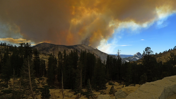 The Meadow Fire, September 7, 2014 from Olmstead Pt. 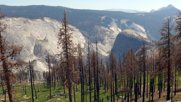 Looking down past the burned forest into the Merced River gorge at Bunnell Pt. with Mt. Starr King in the distance. The forest that once shaded the trail burned down, leaving us to toil up in the full Sun during the afternoon. This was the first of a number of stressful days as I worked out my hydration scheme. Stephanie was the champ going up hill, I felt every bit the old man I was, but my problems probably were always there, feeling ill not because of altitude, but because of exertion. The JMT eventually finds "the switchbacks" which ascends up to Sunrise High Camp. This turned out to be totally exhausting for me. We were running out of time for the day, and we were pretty worked. But not only that, a ranger we had met on the trail up, checked out our wilderness permit and eventually learned of our plan to camp at Lower Cathedral Lake without a bear canister. He was quite upset, but didn't cite us (we didn't have one with us, planning on eating everything) and said that either we should stay at Sunrise, or in the Tuolumne Meadows backpackers' campsite, each of which had bear boxes. If we did not we'd be in trouble! After quite a day we were happy to comply with his instructions. 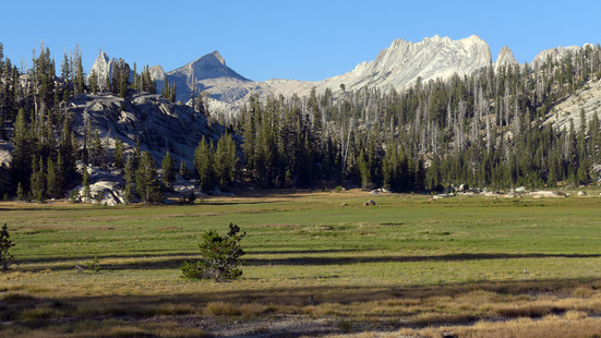 Meadow adjoining Sunrise High Sierra Camp, Matthes Crest in the background. The total distance was 14 miles (though Stephanie's GPS watch showed more, with a total elevation gain of 6960' and loss of 1590'. Our highpoint was at 9700' at 12.5 miles, so we were going uphill pretty much the whole day.
The day 1 kml file has a combination of the various bits of information, including the track from Stephanie's watch.
2 Comments
David Miller
8/8/2022 11:27:12
Hi Ed.
Jeffrey Okamitsu
16/4/2023 15:01:46
Ed. Reminiscing and realized that it’s been too freaking long. Would love to connect with you Leave a Reply. |
AuthorEd Hartouni is a physicist and a climber who lives in Livermore, California. ArchivesCategories |
 RSS Feed